 Follow Us on Google
By Grace Egbunuekhe
Most Lagosians will never see the full infrastructure protecting them from floodwater. Unlike a bridge, drainage infrastructure rarely becomes a landmark.
Much of it lies below roads, behind buildings or along corridors residents ordinarily have little reason to visit. Yet, when it fails, everyone notices.
Perhaps this explains the peculiar challenge of communicating Lagos’s investment in drainage. The public naturally sees locations that flood. It does not always see the kilometres of channels being constructed, restored, lined, dredged and protected elsewhere to keep considerably larger areas functional.

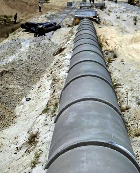
One of the most revealing examples is the Odo Iya-Alaro drainage system, commonly known as System 1. In July 2025, government disclosed that work was underway on a 4.2-kilometre concrete-lined drainage project cutting through Ikeja and Kosofe, with different tributaries ultimately converging around Maryland. At the time of the inspection, the Sheraton-to-Ojota section was reported at 45 per cent completion, with the wider project planned in phases.
The project is important for what it illustrates. Flood control in a dense city cannot be solved street by street. Water does not respect local-government boundaries. A drain in Ikeja may eventually discharge through another jurisdiction.
A blockage kilometres downstream can create flooding upstream. The system therefore has to be approached as an interconnected hydraulic network rather than a collection of gutters. This understanding is increasingly visible in projects elsewhere.
The state reported in April 2025 that 12 primary drainage channels covering 32.5 kilometres had been restored from 2023, while another 84 secondary channels totalling 96 kilometres were restored during 2024.
Among those specifically identified were the 3.5-kilometre System 40 and 40A around Alaba International Market and Franklas Channel; the three-kilometre System 34B Aiyetoro/Iteku/Ishasi Drainage Channel in Ojo; and the 2.5-kilometre System 131 Odo Iraye Channel in Epe.
The geographic spread is instructive. It shows that the flood challenge is not exclusively a Lekki or Lagos Island problem, even though flooding in those high-profile districts tends to generate more public attention.
From Ojo to Epe, Ikeja to Kosofe, Ikoyi to Eti-Osa, the drainage problem follows development.
Other News
As communities become more built up, natural soil capable of absorbing rainfall is increasingly replaced by concrete, asphalt and rooftops. Rainwater that previously infiltrated the ground is converted into surface runoff that must rapidly find its way through constructed drainage systems.
And where those systems are undersized, blocked or obstructed, the consequences are predictable. Lagos Island presents perhaps the most complicated example.
Government’s regeneration works there have included drainage interventions around perennial trouble spots such as Adeniji, Oroyinyin, Idumagbo, Ojo Giwa, Jankara and Aroloya.
During construction in April 2025, temporary flooding in parts of the Island required pumping stations to evacuate accumulated stormwater while primary and secondary drainage works continued.
That episode exposed an important reality of urban regeneration: sometimes the process of correcting decades-old infrastructure problems temporarily disrupts the communities intended to benefit from the solution. Government, therefore, has a responsibility not merely to construct but to explain.
Residents should know where stormwater is meant to go, why particular buildings or structures are affected by drainage setbacks, what construction timelines look like and what temporary measures exist while major infrastructure is being delivered. The same applies to affluent developments.
In 2025, officials inspected drainage projects connected to the Lagos Island regeneration programme, the Shoreline Estate Collector around Onikoyi/Banana Island Road and the Femi Pedro Collector Drain around Parkview Estate.
By January 2026, attention had shifted again to critical alignments around Ogombo, Ikate, Kusenla, Mobil Road and System 46 in the Lekki corridor.
This is what an evolving drainage network looks like: not one spectacular project but a continuous sequence of construction, restoration, inspection and maintenance.
Following severe rainfall in June 2026, Governor Sanwo-Olu authorised dredging and maintenance work on another 28 primary channels.
It is tempting to judge flood management exclusively by the sight of water after rain. But the better test is broader. How much drainage capacity has been restored? Are watercourses that had disappeared beneath buildings being recovered? Are primary and secondary channels properly connected?
Are new developments being prevented from narrowing critical alignments? And when exceptional rainfall comes, how quickly does stormwater leave affected communities? Those are the questions by which the Lagos drainage legacy should ultimately be judged.
Because underneath the roads, houses, estates and markets of the megacity is another Lagos — a largely unseen network whose ability to move water ultimately determines whether the city above it can keep moving too.