Follow Us on Google
From Isaac Anumihe, Abuja
The Surveyor General of the Federation is a man with lofty responsibilities cutting across many aspect of the country.
Apart from land surveying (also known as cadastral surveying), there are other types of surveying including, engineering, mining, hydrographic (bathymetric) and geodesy as well as aerial and topography surveying.
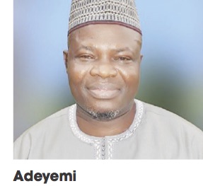
This makes the Surveyor General of the Federation a generalist, a position, Surveyor Abuduganiyu Adeyemi Adebomehin occupies.
In this interview, Adeyemi identified parts of Nigeria that are prone to earthquake.
According to him, the Office of the Surveyor General of the Federation (OSGF) is the office mandated to produce maps, hence his threat to arrest and prosecute people producing maps illegally in Nigeria.
He also condemned the indiscriminate drilling of boreholes in Nigeria, warning that the nation is postponing the evil days.
As for the frequent building collapse in Nigeria, he blames all the professionals in the built industry for complicity. Excerpts
Is Nigeria prone to earthquake?
Nigeria remains one of the luckiest nations in the world considering that natural disaster like earthquakes rarely occur in the country.
There is a committee called United Nations Geospatial Information Management Unit. They advise all member states to establish what we call Continuously Operating Reference Station (CORS). Before now, we used to have what we call controls and benchmark. Controls and benchmark are passive stations. They are passive in the sense that they are there even when we go to sleep. You’ll only need equipment to go back to know whether the position he is telling you is still the same thing. But because of development, the committee now says go and establish active stations. When we have our active station, it should be able to give us information 40 kilometers from where it’s stationed. The aim behind that is to be able to predict when there’s going to be an earthquake. What’s an earthquake – when the celestial bodies come in contact with themselves. There’s going to be a kind of two forces going in opposite directions. The ground cannot contain such a force. You need to look at a star under the telescope and you will see that the star can consume the whole earth. So, when these forces come in contact with each other, that force cannot be under the ground. They now find a way on top. So, that is another field in geodesy. We call it tectonic movement. The effects of that force is what comes on top.
Which areas are prone to earthquake in Nigeria?
We have had an earthquake in Kaduna before but they said it’s a mild earthquake. We had in Ijebu Ode. But we were allowed to tell people of what we saw then. I was the head of that team with my director then who came after my research. There was a mild earthquake there. But they said that there was no earthquake. The land only shook.
Borehole drilling
When the authorities leave their responsibilities we are only shifting the doomsday and that which you have just mentioned is a very serious issue. Disturbing the system on its own is dangerous. It’s not a system put in place by me or you. It’s a system put in place by God Almighty. And anytime we drill and we remove the resources, there’s need for us to fill it back with another substance (especially if the borehole fails). But when somebody drills a borehole and it fails, he will just go and drill another one. It’s an ecosystem on its own.
In an estate everybody drills a borehole instead of coming together to drill one. But because I don’t like you and you don’t like me and we don’t trust one another, boreholes are drilled indiscriminately. On its own, it will have a long time effect. It’s a study on its own because by and large we distort the nature on its own.
As adviser of the Federal Government, what’s the way out of indiscriminate drilling of boreholes?
Well, it falls under the purview of another Ministry, Department and Agency (MDA). There’s a department in agriculture and water resources ministry that is in charge of it.
They have a department called hydro and hydro-dynamics (H and H). That department looks into what is happening under the earth’s surface. Any time they stop any natural ecosystem there’s going to be consequences
What is your collaboration with National Boundary Commission?
National Boundary Commission used to be part of this office.
It seems you have conflicting roles now?
No. We don’t have conflicting roles. When people see it from outside they will say we have conflicting roles. We don’t have conflicting roles. When you look at a system that works outside the country you are always advised by the United Nations to adopt that system. The National Boundary Commission used to be part of this office but they are basically in charge of history which we call adjudication. Look at the history of that boundary and from the history of that boundary tell us what we need to know and what we don’t need to know. How does the line run from one place to the other which we call history of the boundary and that is adjudication. But there was a time they were lucky and they had a lot of funds. Then they employed a few surveyors. What we are saying is that there’s no conflict of roles there.
Do they survey?
They don’t survey. Anytime they are through with what they are doing, they will bring it before this office. It is now time for us to go for delineation, delimitation and demarcation (3Ds). And when they do that it’s the representative of the Surveyor General of the Federation that will sign on that map. That becomes a legal tender. It’s only of late that if we go out together and they bring in somebody who is a surveyor as part of that team. If I sign the document, that person can sign and all the surveyors in Nigeria are under the Surveyor General of the Federation. They’re pool officers. So, there’s no conflict of roles.
Here we have 14 technical departments. In National Boundary Commission they don’t have hydrographic department. It’s only the Surveyor General of the Federation that can define that entity called Nigeria. The National Boundary Commission cannot produce map of Nigeria. But when we go out to work they will do the history and we’ll put in bicorns that define that pole.
The Vice President is the chairman and the deputy governors of the states are in charge of boundaries.
The real owners of the boundaries are the indigenes and they will be invited and they will talk on camera.
Relationship with National Emergency Management Agency (NEMA)?
We have two or three of our officers as the members of their board because they use maps a lot and we have to define the entity called Nigeria. Again, we are in charge of research and rescue. When there’s a disaster we need to put up evacuation. When there’s a disaster nothing is normal again. The road to that place is not normal. They need a helicopter to go there. There’s a committee on research and rescue made up of surveyors and officers from other departments. Some will provide relief materials and other things but the main people that will go for evacuation are the surveyors.
Relationship with National Airspace Management Agency (NAMA)?
NAMA is another agency we collaborate with.
In fact, there was a time we even sent some of our staff to train them. We need some equipment to produce the obstacles maps. Obstacles maps show where we have the hills, where we have towers, where we have mass. This is because in the air or desert any way is a way. Any way plane faces is a way. But in the control tower and above the aircraft, there’s a Global Positioning System (GPS). So, all the obstacles, all the trees, all the equipment, buildings along that area, we need to pick their co-ordinates, convert it for them and put it as a chart. Of late, if you want to give anything to the United Nations and it concerns geo-information management they will take it to the surveyor general to sign. Why will you sign what you don’t know? Not that it’s not part of our job, but they didn’t recognise us before now. That’s why if you want the surveyor general to sign anything for you it’s a million naira.
What’s your role in building collapse in Nigeria?
We only give advice. We don’t have dichotomy. I’m a surveyor. I am to give information on the extent of the land. When they want to design, that man who does not know the shape of the land will go and design without the surveyor. They will now design out of proportion. And if you look at building there are people they call building engineer. They are not civil engineer. It’s a field. They are builders. There’s another department they call structural department. They are to look at the columns and the roles. They look at the strength of that material. There’s another field in surveying that looks at the geo-technical of that land.
Between structural engineer and surveyor who’s to blame?
Blame everybody. Blame all of us. In Nigeria, once they give you the shape of your land, you just go—–no soil test. So, the blame is for all of us. That’s why they had to come up with building collapse committee. So, all professionals came together to get it right.
Maritime security
Surveying is ubiquitous. Nigeria Maritime Administration and Safety Agency (NIMASA) and Nigerian Ports Authority (NPA) will receive information on any ship that’s coming to berth in Nigeria from South Africa. Hydrography is the survey of the bed of that river. In the air, anywhere you face is a way but if you have a GPS, you will now know your direction. In the air too we have route. That is why we have navigational chart. You can’t face anywhere otherwise there will be serious crisis. Ditto we have the same thing in the sea. It’s the surveyor that will do the survey of that bed of the sea.
Mapping in surveying spaceMapping is supposed to be one of the departments in this place. But there was a shortfall in mapping. That’s why (because it’s a specialised field) the Economic Commission for Africa (ECA) decided to establish regional schools. We have about four branches. There’s one for West Africa. There’s another one for East Africa. There’s another one for North Africa. I think there is another one for the Caribbeans. You know that the Caribbeans are partly Africans and partly Europeans.
Nigeria is in charge of the development of that school while about eight other members contribute to run the school in terms of remuneration of staff.
Already, we have provided the land but there’s need to provide infrastructure. Nigeria solely provides physical infrastructure. That’s why our last survey conference was held in that place so that we can at the same time look at the facilities around and assess it. The school was established in 1972. Last year was when they marked their 50th anniversary. But it’s not just enough to look at what you have 50 years ago and feel that it’s in tandem with what is obtainable in the world now. So, we took pain to look at their curriculum and their programme and asked them that there’s need for us to review some of these these things. The one that comes to mind is the bungalows they have there. The structures are all bungalows.
There’s need for them to look at super-structures. Ab initio, when the school was set up they had excess land. And now that the school is a specialised university it’s moving away from the core mandate of assisting member states in manpower development in mapping. It’s now a regional university because Obafemi Awolowo University (OAU) used to assist in terms of accommodation. Now that OAU has accommodation problem they have to ask them to look for their own accommodation.
That doesn’t mean that they don’t have their own accommodation. When I was in that school the total number of students was not more than 80. Now, the staff strength alone is over 80. So, these are some of the activities of the school that we try to look at and review. So, that is as per the school.
Proliferation of maps?
In all ramifications, nobody has the right to produce maps. It’s solely the prerogative of this office – Office of Surveyor General of the Federation – to provide maps. That’s why we have a bill before the National Assembly on proliferation of maps to stop people from producing maps. Even if you have something you want to add which we call added advantage on other map, we are to provide the base map. Let’s assume we want to provide information on the vegetation, we produce the map for you. But because you have a specialised field it is now left for you to add the added advantage on that map. It’s only the Surveyor General of the Federation that can give that entity they call Nigeria.
How have you handled the infraction?
That’s why we have the bill in National Assembly. And that’s why the next co-ordination which we are going to host here in Abuja is going to be on that because often times when you go to National Security Adviser (NSA) and we talked about infraction, he asks me how come we have not been able to make one arrest. And because of that he attached a very high-ranking security officer to this office——– a major general—-to be in charge of infraction. But it’s not easy for you to start arresting people. You need to look at that law. You need to carry out sensitisation. You need to let people who call themselves sister agencies to know that that law which we call the Surveyors Co-ordination Act of 1960 has now been revised and this is what the law says now. If that’s what the law says now, there’s need for you to know now that if you do that that’s now an infraction and there’s a penalty.
What have you done about advocacy?
Under cadastral we used to have bicorns that define the owner of a property. If you remove that bicorns under the old law it used to be able N50. So, if you try to remove all the bicorns in this locality and the federal total should be under N2,000. If they take me to court and I plead guilty, I will pay only N2000 and go home. Now there’s a committee to look at the law to come up with the pros and cons. What are the sections of the law that we still agree with? What are those laws that we feel that they are obsolete like the one I told you, about.
But if any law is an act of the parliament, to review it you must have two-thirds of the majority. These are some of the reasons we find it extremely difficult to review that law. But what we are going to do now is either to leverage on the strength of the current minister of Works and Housing or the Attorney General of the Federation that this law is long overdue for revision. If they agree with us, we can now ask the president to take it as an executive order. But where we don’t have the privilege we go to the national assembly to pass to the states because surveying falls under concurrent list. Whatever belongs to the state governments, the local governments, the federal government in terms of assets is kept in one room here which is called the data centre. It is the depository of all geo-spatial information in the country.
How do you marry states and federation government laws with surveying?
It’s very simple. We all rely on the same task-payers fund. But there’s this land reform act that says that the land belongs to the governor. The governor of each state of the federation holds the land in trust for the federal government. When the federal government needs to use land for any purpose they will write to the governor and the state will now oblige. That’s why we are having infringement because they are two things. If the federal government wants to use any land for any purpose you’re not supposed to go for C of O on that land. This is because a C of O will give you a tenure maybe for 50 years or 90 years. This is some of the mistakes and that’s what we are fighting now. That means at the expiration of that land we need to come back to review the land. A case in question is the federal secretariat in Lagos. There’s always a place to change the purpose but the easiest way to run away from the entanglement is to say multi-purpose. When you make the mistake and say it’s for residential, it’s going to be strictly for residential. That’s what the Lagos State is telling the federal government now that for it to change the purpose for which the land was acquired, you need to come back and reapply. But they didn’t say do not own the land. They (Federal Government) own the land but you can’t change the policy.
Is the Lagos Federal Secretariat land up to 99 years?
I don’t think it’s up to 99 years. But the argument now is that the purpose for which the land was acquired is no longer what the federal government wants to do with it. So, it needs to reapply.
So, we don’t the exclusive right of the land.
And that’s the mistake we are making. Any land in Nigeria under the land use act and its amendment we are not supposed to go for tenoreship.
What’s the relevance of Office of Surveyor General of the Federation to national security?
This office is grossly under-funded. One of the officers that was recently posted here told me that he thought that I was overblowing the services of the office. So, he decided to go on the net to search for the office. When he came back he said that there’s need for us to do a lot of sensitisations.
He said that as at the time he was coming here, he almost rejected the posting but he’s pleased to work with us.
On security, the office used to be part of the military. But something went wrong. The surveyor general was supposed to be a major general in the army. But when they downgraded the office to the office of a colonel, the then surveyor general rejected the offer. A committee was set up to decide on the matter. The result was the separation of the office from the military.
Recently, Russians sent a drone to the camp of Ukraine and it killed a lot of people. So, when you talk of warfare it’s not the number of personnel that you have. It’s partly a function of intelligence. So, when you talk about intelligence, you do some research; you have your surveillance. No matter whoever is producing maps in this country you require the signature of Surveyor General of the Federation before it’s tenable. That’s why when people tell you that they produce maps they just produce maps for themselves.
Very soon we’ll start arresting people selling maps on the roads because the source of their information is questionable. And if you want to produce maps for business, we have a department. So, if you come in here you sign an agreement with us and we give you the maps you can then add whatever you want to update. Maybe you want to advertise some companies. So, when you do that you can then go to the streets and sell.
How does insurgency affect your operations?
It affects us a lot. Just yesterday we were holding a meeting here and the zonal director in Maiduguri reported that the drone in Maiduguri had been blown up by insurgents. We are now looking at how to put another drone in that area. The first one was blown up and the second one was donated to the Vice President-elect now. That was why because we assisted them during the time he was the governor of Borno State. Because of our impact in the farm then he gave us 2.5 acres of land. So, we put another drone in that place so that we will be able to secure the land when the coast is clear. They went back and damaged it even though it was close to the security post there. This has eaten very deep into our costing. Before, we were not thinking about security when we went out. We saw everywhere as a safe place. Now we move out with a team of the military or mobile police. In Nigeria-Cameroon boundary we lost six of our officers.
That’s why we had to write National Salaries Incomes and Wages Commission (NSIWC) and argued that if doctors are entitled to hazard allowance, we are equally entitled to hazard allowance.
So, insecurity eats very deep into our planning. Before I approve anything I will look at community relation. If you go outside to work you must present yourself to the community. In some instances, the community will give you local guide. The local guide will not follow you to the field free of charge. You have to write the Inspector General and he will pass the information to the commissioner of police in the state. Surveying is a very risky job. We have had an incidence where a surveyor general was tied to a tree.
How safe is Nigeria in terms of natural disasters?
Nigeria is safe but I think I will just want to appreciate the number one citizen of the country. General Muhammadu Buhari for his doggedness. It’s not easy to rule Nigeria. We have over 200 dialects. I don’t know if he sleeps or he doesn’t sleep. We appreciate him for his efforts all these years. We have to thank him and appreciate him for all he has done. In all, when you talk of security it’s only the Commander in Chief of the Armed Forces that will tell us how he has fared and how he has been able to curb it.